11 Apr 2013
Forty Hall 'Greenway' Progress
The major part of the archaeological monitoring of the track under construction in Forty Hall is now complete. As mentioned previously, despite the shallow cut and routing of the path around the very edge of the park, the work has provided us with several windows into archaeology we have not had a chance to see before.
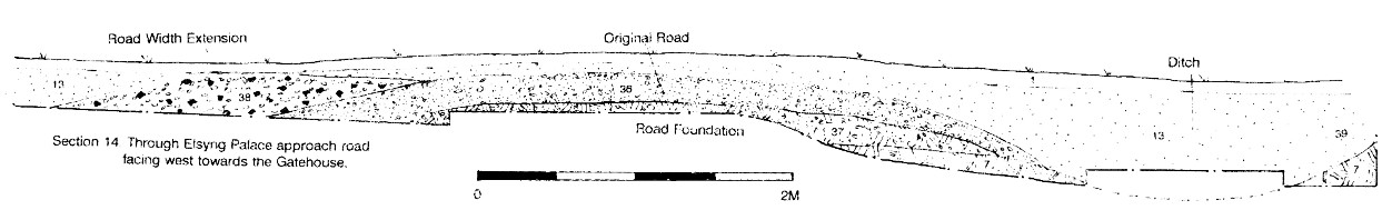
One of the more significant areas we studied was just inside the woods opposite Jesus Church, where geophysical and remote sensing surveys suggested the main approach road to Elsyng Palace once ran between the road of Forty Hill and the site of the outer Tudor court (now under the lime tree avenue).
As predicted, a heavily compacted and cambered gravel road surface was revealed, flanked by two ditches, and even showing tentative signs of later widening -- perhaps necessitated by the palace's rapid growth under Henry VIII.
This confirmation of the palace road is significant, because it underpins much of our interpretation of the layout and orientation of the rest of the site; particularly the outer courtyard and gatehouse.
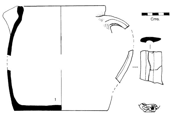
Ceramic finds from the tile spread near the car park have now been formally studied and strongly suggest that this is indeed a palace era feature.
The work has also produced a fascinating range of struck flint tools, which have been broadly dated to the bronze age.
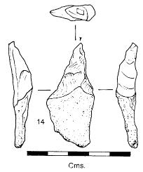
This fits in with the large number of lithics we recovered from the field behind Jesus Church during our excavation and monitoring work in 2008 and 2009, and adds to the evidence of the prehistoric settlement of Forty Hill during the late neolithic and early bronze age.
As ever, more details of the work and its contribution to our knowledge of the palace and post-palace landscape will feature in upcoming editions of the society newsletter.